|
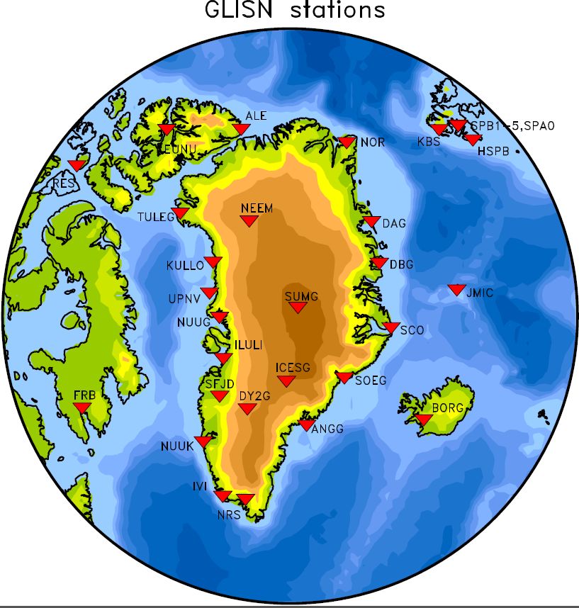
The GLISN (Greenland Ice Sheet Monitoring Network) project has established a real-time sensor array of 33 stations
to enhance and upgrade the performance of the scarce existing Greenland seismic infrastructure for detecting, locating, and characterizing glacial earthquakes and other cryo-seismic phenomena, and contribute to our understanding of Ice Sheet dynamics. Complementing data from satellites, geodesy, and other sources and in concert with these technologies, GLISN will provide a powerful tool for detecting change and will advance new frontiers of research in glacial systems; the underlying geological and geophysical processes affecting the Greenland Ice Sheet; interactions between oceans, climate, and the cryosphere; and other multidisciplinary areas of interest to geoscience and climate dynamics. The development of the telemetry infrastructure linking the sites together into a coherent framework creates the temporal resolving capability and potential for rapid scientific response. All data from GLISN will be freely and openly available to anyone in real-time, without restriction.
|